Mt. Whitney Hike
July 4th, 2006
(by F. Peinado)
When Sean was 15 years old and I was 50, we both went together to the top of Mt. Whitney, the highest peak in the US outside of Alaska. It was one of the most special times with my son in my life. We talked, laughed and walked, walked, and walked. When I got home, I felt so grateful to have shared that experience with him that I wrote this, thinking one day he might want to read it and remember what it meant to me. I thought I would share it with others now.
When preparing for my hike up to Mt. Whitney with Sean, I wanted to get some impressions on what to expect. I bought a book on Mt. Whitney and checked out some web sites with related info, but most of the advice I found seemed to be directed at more experienced climbers, with an abundance of technical climbing language that I was not familiar with. I felt I needed advice more at the “average Joe” level. But that “Bla, bla bla for Dummies” series doesn’t seem to include “Mt. Whitney for Dummies,” so I felt I had trouble getting more personal and basic angles on what it really takes to make it to the top (and back…).
With that in mind, I have written this brief description of our experience hoping that it might help friends or acquaintances who plan to hike to the top some time in the future. I also intended this to be a memoir for my own use, of course.
One of the things I was very worried about was altitude sickness. I had gotten it before, once pretty severely, even at 11000 feet, so I knew that if I got it on my way up to Whitney (14500 ft) I just would not be able to make it. The thought of all that planning and time spent on this trip to eventually have to turn around because of a severe headache or nausea, was discouraging, at best.
So my doctor prescribed Diamox, which is intended to prevent altitude sickness. I asked him if I could share half of my prescription with Sean and he said yes. He recommended that we try taking one pill several days before we went on our trip so that we could find out if we got any kind of uncomfortable symptoms ahead of time. We did. Sean felt a little sick to his stomach, and I felt the same, and in addition, could not feel the bubbles when drinking cola. It also tasted sour. Very unpleasant.
But we thought that would be a small price to pay compared to altitude sickness, so as prescribed, we took our first pills the day before we left Santa Barbara.
With us, we took our full backpacks and a day pack each for our ascent. In the day pack we had all the things that my book had recommended we take (see list at the end of this text)
We first went to Wawona and spent a night there.
We watched a couple of World Cup games and left the next day at noon for Toulumne Meadows, where we were to spend two nights backpacking and camping at high altitude to acclimatize our bodies, as the book had recommended.
We camped the first night on the Ten Lakes Trail, at around 8000 ft.
We camped the first night on the Ten Lakes Trail, at around 8000 ft.
The next morning we hiked about 4 miles back out to the car and went to hang out by Tenaya Lake for an hour or two.
Then we hiked another 4 miles or so to Sunrise Lake (9000 ft). The trail was steep and still had a lot of snow, which made it quite difficult to climb. Campsite was infested with mosquitoes so we pretty much spent the rest of the day inside the tent, reading and avoiding the nasty critters.
Then we hiked another 4 miles or so to Sunrise Lake (9000 ft). The trail was steep and still had a lot of snow, which made it quite difficult to climb. Campsite was infested with mosquitoes so we pretty much spent the rest of the day inside the tent, reading and avoiding the nasty critters.
The next day we hiked back to the car and headed for Lone Pine to get our Whitney permit. The campground at the Whitney Portal was completely full, so I asked the ranger at the permit office in Lone Pine if she thought sleeping in Lone Pine would ruin all the previous acclimatization we had been working on. Her answer was “not necessarily.”
With that, I got a room at the Comfort Inn, which ended up being very helpful because Sean hadn’t slept too well in the tent the previous two nights and I was worried he’d be too exhausted for the climb.
With that, I got a room at the Comfort Inn, which ended up being very helpful because Sean hadn’t slept too well in the tent the previous two nights and I was worried he’d be too exhausted for the climb.
The hotel room also allowed us to take a warm shower when we got there and another one before we left the hotel, at 3:15 am, on our way to the trail. For me, a warm shower in the morning really relaxes my muscles, wakes me up, makes me feel clean, and makes it much easier to get on the trail.
I think Sean felt the same. We had gone to sleep at 8 pm, after watching “Jaws” on TV. So, despite getting up at 2:45, we almost got 7 hours of sleep. We both felt pretty well-rested, and in retrospect, I think this was a key factor in our successful ascent.
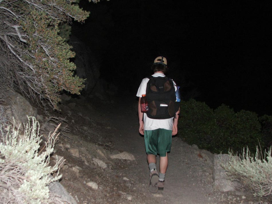
We got to the trailhead at 3:40, put our extra food in the bear box, and headed up the trail in a moonless sky, with our flashlights strapped to our caps. The sea of stars and the dark silhouette of the mountains created an impressive sight.
I think Sean felt the same. We had gone to sleep at 8 pm, after watching “Jaws” on TV. So, despite getting up at 2:45, we almost got 7 hours of sleep. We both felt pretty well-rested, and in retrospect, I think this was a key factor in our successful ascent.
We got to the trailhead at 3:40, put our extra food in the bear box, and headed up the trail in a moonless sky, with our flashlights strapped to our caps. The sea of stars and the dark silhouette of the mountains created an impressive sight.
Our Whitney book had warned us not to speed on up the mountain from the gate, so we tried to slow down the pace, but in all honesty, I don’t think we did a good job at this. Sean lead all the way and his pace was somewhat restrained for the first hour, but then picked up speed at a pretty amazing pace. I usually walk at an above average speed, but even so, I was having trouble keeping up with Sean. A few times I had to ask him to wait for me. Still, an in all, we averaged out the same speed, which is also pretty crucial in something like this.
The book makes a strong point to choose your hiking partners well. Hiking with someone who is too fast for you will tire you out just as much as hiking with someone who is too slow for you. A normal, comfortable pace, is essential at all times, so your partner(s) should walk roughly at about the same speed as you.
For the first hour and a half we had to use our flashlights. As we gained elevation, and passed a couple of parties on the trail, we could see flashes of lightning in the distance, towards Death Valley, but the sky above us was completely clear.
As it got lighter, we turned our flashlights off and carried on. Sean would point out sections of the first four miles of the trail that he recognized from a previous failed attempt to summit on a trip with his friend Matt, his dad, and his friend Spencer. They had camped at Outpost Camp, four miles from the start, but had to turn back the next day because Spencer had altitude sickness. That was in May of last year, and seeing the conditions we found now, in July, it seems impossible they could have made it to the top without ice axes, crampons, and even ropes, none of which they had or had ever used, I believe. So actually, Spencer’s unfortunate sickness saved them a lot of potential grief, had they carried on.
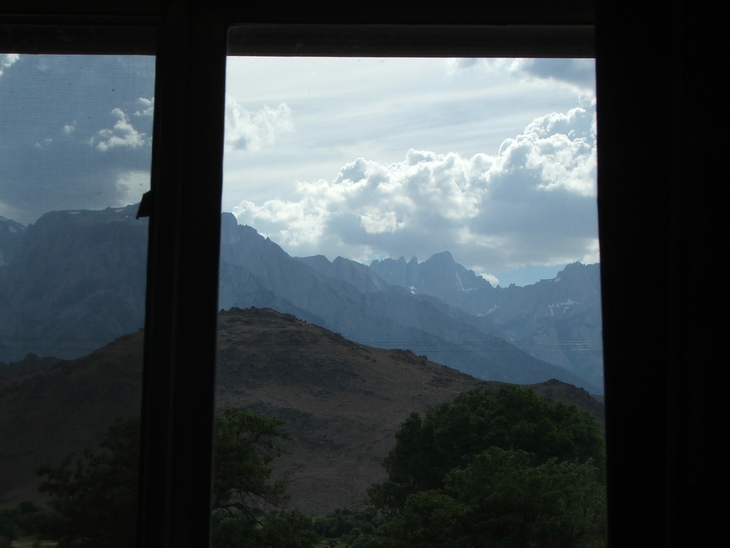
As the sun popped up, the day was absolutely glorious, and the scenery all around us was just amazing.
The book makes a strong point to choose your hiking partners well. Hiking with someone who is too fast for you will tire you out just as much as hiking with someone who is too slow for you. A normal, comfortable pace, is essential at all times, so your partner(s) should walk roughly at about the same speed as you.
For the first hour and a half we had to use our flashlights. As we gained elevation, and passed a couple of parties on the trail, we could see flashes of lightning in the distance, towards Death Valley, but the sky above us was completely clear.
As it got lighter, we turned our flashlights off and carried on. Sean would point out sections of the first four miles of the trail that he recognized from a previous failed attempt to summit on a trip with his friend Matt, his dad, and his friend Spencer. They had camped at Outpost Camp, four miles from the start, but had to turn back the next day because Spencer had altitude sickness. That was in May of last year, and seeing the conditions we found now, in July, it seems impossible they could have made it to the top without ice axes, crampons, and even ropes, none of which they had or had ever used, I believe. So actually, Spencer’s unfortunate sickness saved them a lot of potential grief, had they carried on.
As the sun popped up, the day was absolutely glorious, and the scenery all around us was just amazing.
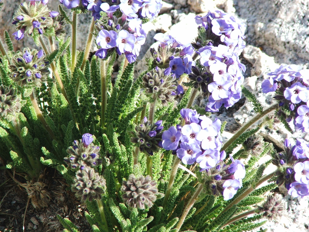
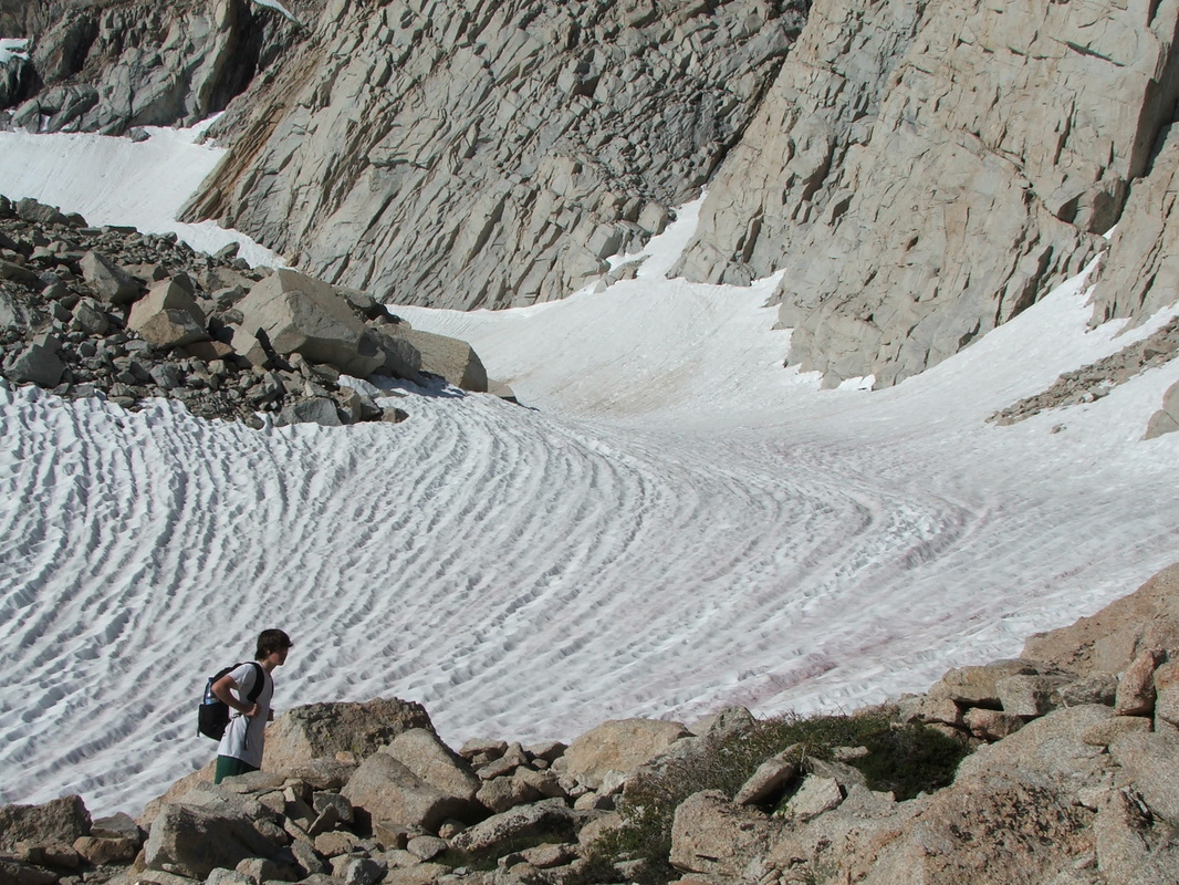
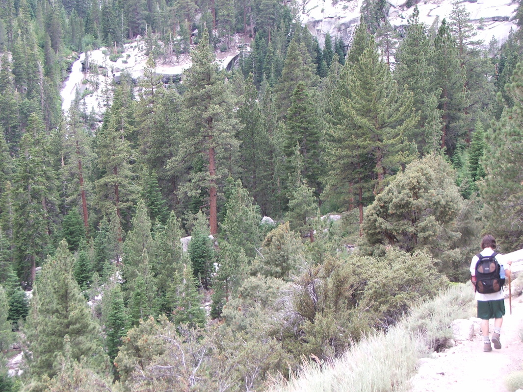
At about the fifth mile of the trail, we passed the tree line, and now it was pretty much all rock and snow, with a few wildflowers and small grassy meadows here and there.
At Trail Camp, the last possible place to camp before ascending, there were about 6 or 7 tents, and people were getting ready to go up. Meanwhile, with Sean’s furious pace, we kept passing everybody on the trail. But there was one lone hiker, who had started his hike after us, who passed us at top speed. We called him “Robo Cop." He was not very friendly, either, and barely responded when we said “hi."
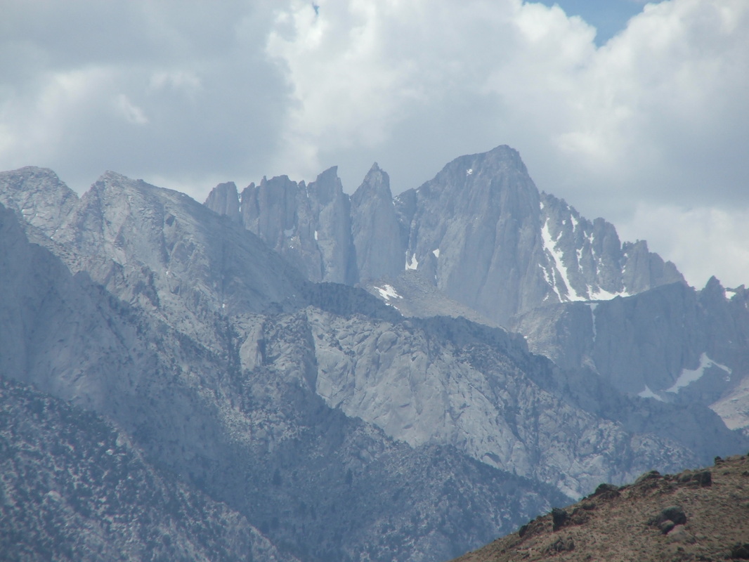
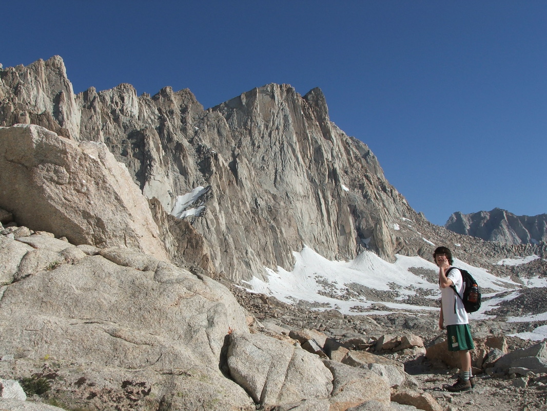
From Trail Camp, Whitney is clearly visible. You just look up, and there it is, like a mean monster, daring you to hop on his head. Snow fields here were more abundant and huge.
From Trail Camp, Whitney is clearly visible. You just look up, and there it is, like a mean monster, daring you to hop on his head. Snow fields here were more abundant and huge.
The infamous “97 switchbacks” start at this point, and as we looked up, we could see some hikers already close to the top, about two miles away from us. Other climbers were going up a section called “the chute," covered with snow, and therefore avoiding the switchbacks by climbing straight up that wall of snow. But from the distance, you could see the tiny dots in the snow moving at a snail’s pace.
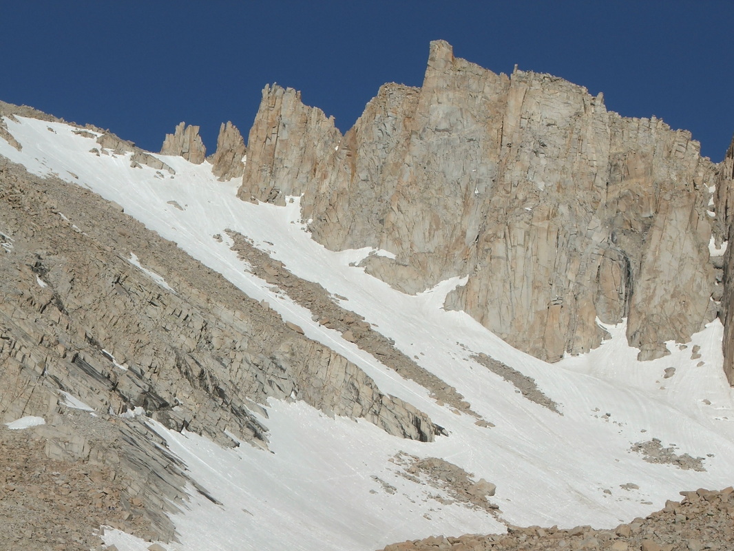
It didn’t seem like a quicker option. Then, once on the switchbacks, it was also apparent that they not only had about 2000 feet of snow to hike on, but that that whole section was extremely steep, and that unless you had crampons and an ice axe, it would be suicidal to even attempt it. One small slip would be the end. In fact, when we were given our hiking permit, there was a section on fatalities last year. They totaled 5. Two of them had been climbers attempting to summit along the mountaineer’s route, with ropes and gear, two others had been a father and his son, struck by lightning as they descended the “97 switchbacks” (more on that later on), and the fifth had been a 45 year-old man attempting to glissade (slide down) that snowy chute. He had lost control, picked up speed on the way down, and died.
Needless to say, “the Chute” was not an option for us. But the switchbacks had a few nasty snow sections to negotiate, which weren’t that “encouraging." This has been a winter of particularly heavy snows, especially late in the season, so even in early July, the snow was a problem on the trail.
Needless to say, “the Chute” was not an option for us. But the switchbacks had a few nasty snow sections to negotiate, which weren’t that “encouraging." This has been a winter of particularly heavy snows, especially late in the season, so even in early July, the snow was a problem on the trail.
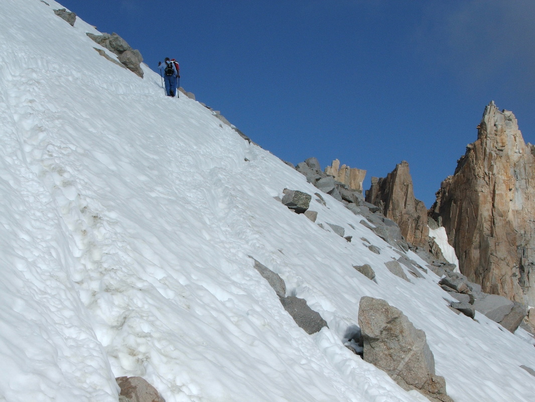
Those sections all had people’s tracks on them, so that helped a great deal in traversing them, but some of them had 2000ft drops to one side, so our concentration going through those was extreme. We went through them very slowly and made a point of digging our finger in the snow on the upside of the mountain for better balance. This made our fingers painfully cold, but it was some added protection from a possible fall.
As we finally completed the “97-switchbacks”, we came to a section called “trail crest”, at the very top of that mountain range, where you have a 2000 ft drop on one side of the mountain, and a 3000 ft drop on the other side. And at the top, there is no more than a 5 to 6 ft area in which to stand. The wind was strong there, as it usually is in places such as this one, but as we popped our heads over the ridge and looked at the other side, the view was simply spectacular.
As we finally completed the “97-switchbacks”, we came to a section called “trail crest”, at the very top of that mountain range, where you have a 2000 ft drop on one side of the mountain, and a 3000 ft drop on the other side. And at the top, there is no more than a 5 to 6 ft area in which to stand. The wind was strong there, as it usually is in places such as this one, but as we popped our heads over the ridge and looked at the other side, the view was simply spectacular.
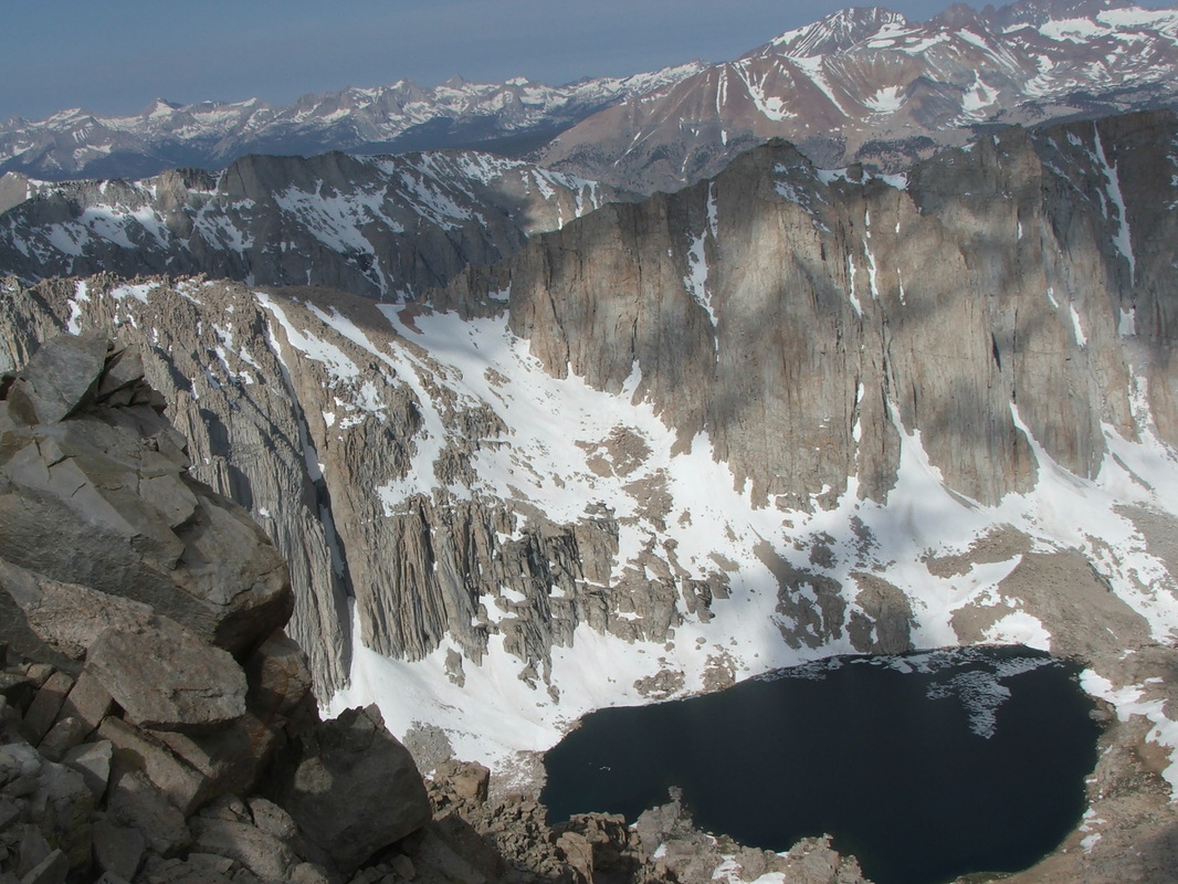
I would say that this has to rank as one of the top 5 views I have ever seen. What you look at is the eastern region of Sequoia National Park, where very few people hike to (it’s about 100 miles from the main visitors center). We took a few pictures there, but none of them do justice to the feeling you have when you are actually there. It is truly an unbelievable sight. Even Sean, who is not easily moved by “impressive nature sights,” said, “Pretty ugly view, huh, dad?”
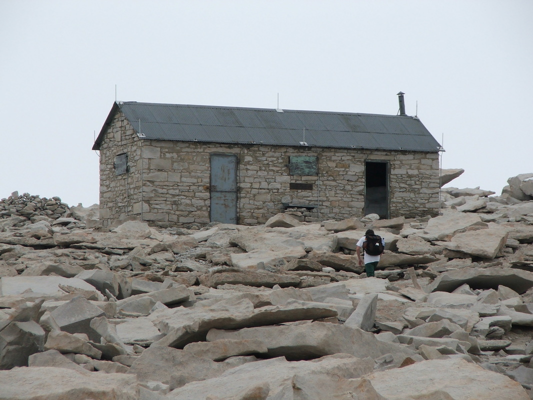
Within the next few yards of this spot, we found several parties of people resting, trying to breathe at 13500 ft, and trying to regain their energy. But Sean plugged along and we passed them all, including “Robo Cop”! This last section of the trail to the summit is about two miles, and goes along the back side of the range, gradually inching up to reach those extra 1000 ft. Because the air is extremely thin here, that last section is tough. It is easy to get dizzy, and hard to take a full breath of air.
At 10:15 am we reached the summit.
It had taken us exactly 6 hours and a half, and we were the fourth people on the top that day. We had passed everybody except one guy who had gotten there a few minutes before us and two other guys who came up the face with ropes. All three of them had already entered their names on the register.
It was an amazing feeling to have made it, but it didn’t last too long. There were already some clouds parked on the summit, and as we were writing our names on the register, a few snowflakes fell on the paper.
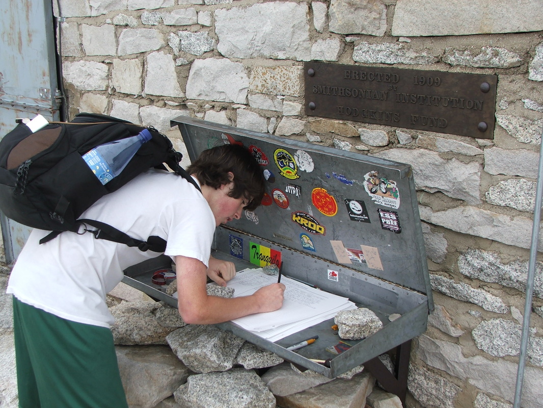
Sean was very hungry, so I pulled out a roast beef sandwich we had bought in Mammoth, on our way from Toulumne to Lone Pine.
We sat down, ate, took a couple of pictures,
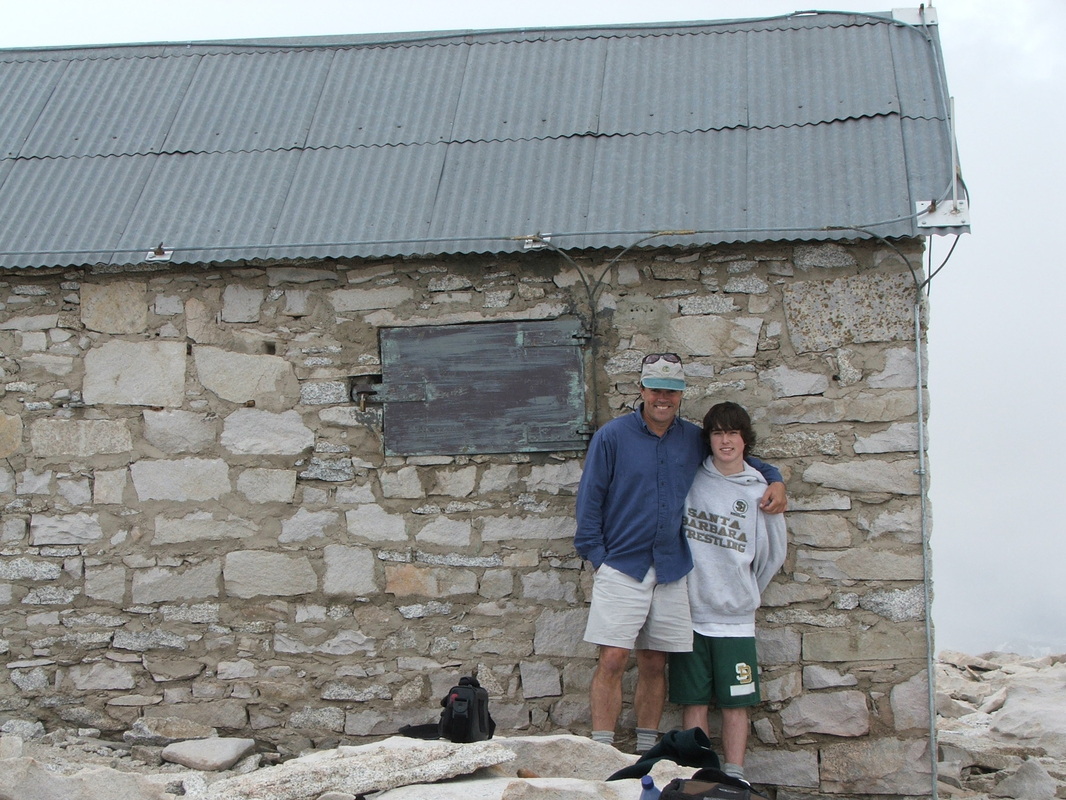
and right away thunder exploded, with flashes of lightning. This was the beginning of the roughest part of our trip.
Having spent 30 minutes at the top, we started our descent as quickly as we could. Now the wind was picking up, sleet and snow were falling heavily, and the air got painfully cold.
Having spent 30 minutes at the top, we started our descent as quickly as we could. Now the wind was picking up, sleet and snow were falling heavily, and the air got painfully cold.
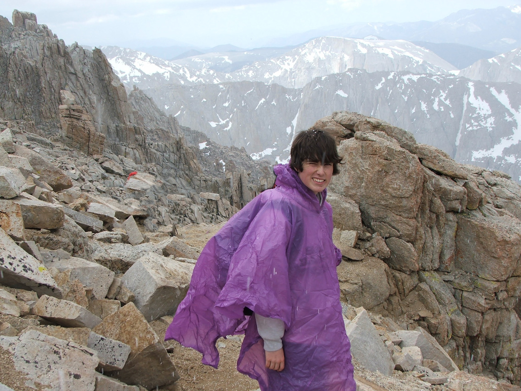
Thunder and lightning kept picking up, too, and all we could think of was to get down from the mountain. But we had two miles to go back to the crest, and then we had two hours of switchbacks all the way down, in totally exposed terrain, with nothing to seek shelter in. This was also the section where that father and son had been struck by lightning, so, understandably, my heart was thumping at a pretty furious pace. At times, it was so intense I could hear it loudly. I had never heard my heart thump that hard.
Along the way, we ran into all those parties that we had passed on the way up, and almost all of them wanted to ask us if we thought they should continue on to the summit. If we thought they should continue? What kind of advice could we possibly have given? People could tell it was insane to carry on, but you could see in their faces that the thought of turning back after having been so close to the top was making them sick. Most of them did carry on, though. Including one guy who had one of those Lycra shirts and said, “I wonder if I should keep going. I’m so cold and didn’t bring anything else with me. Well, we’ll see what happens…” And he marched on to the summit. As we left him behind, Sean said “He’s out of his mind!”
When we got to the trail crest spot and started to descend down the “97 switchbacks,” the storm was at its absolute peak. Lightning was hitting everywhere. I think I didn’t panic only because I didn’t have time for that. All my brain could do was to think of getting down as soon as possible. We were wet, cold, and now, as if I needed it, I was also feeling altitude sickness. I needed to pee, and tried 5 or 6 different times, but I felt so weak, I couldn’t find enough strength to finish the job. And as I tried repeatedly, the pressure caused me nausea.
Sean was feeling weak, too, and for the first time, our spirits were really low. But we kept at it, mostly in silence, and made it to the bottom of the switchbacks, where everybody was seeking shelter from the freezing rain.
As we paraded through several parties, everybody wanted to know if we had summited, and one older lady wanted to congratulate us and just chat. But we were so cold and I felt so sick, we just said “gotta go” and moved on.
This all comes to prove that Diamox is not fool-proof. I’m not sure how I would have fared without it, but with it was no complete solution, either. The same goes for Sean. While he didn’t feel altitude sickness symptoms, it’s possible he might have not felt them even without Diamox. Some people get it, and some don’t. And from everything I read, it’s unrelated to age, physical condition, etc.
As we kept descending down the trail, the temperature got a lot less cold, and now it wasn’t even raining. But Sean was severely fatigued, and could barely walk any more. We were still 2 hours away from the car, so I gave him my walking stick and had him rest his other arm around my shoulder so we could walk slowly together. He said, “Dad, it’s like my brain is telling my leg to go but it won’t listen.” His hiking boots were also too small for him, so he was feeling pain a lot more on the downhill.
But about 30 minutes from the end, with the parking lot visible, he got a second wind and picked up his pace again, without any need for my shoulder.
We were back to where we had started 13 hours earlier. We were exhausted. We had experienced physical (and mental) limits we never knew before, but we were now safe and proud.
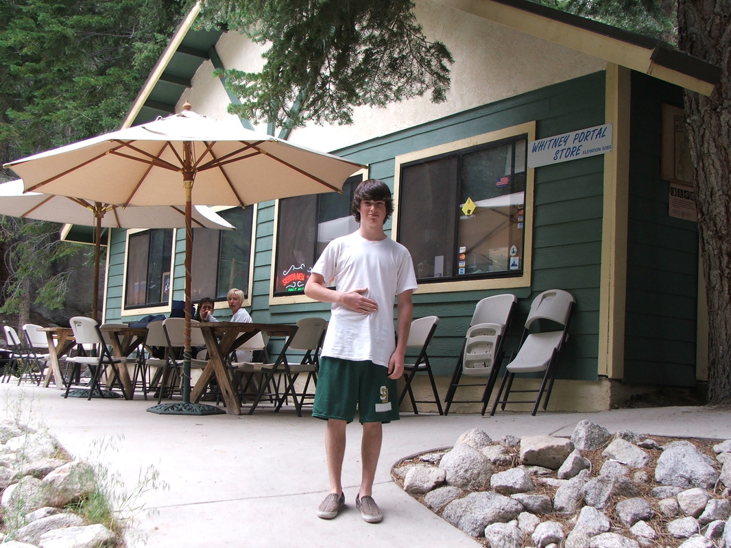
Sean opened the van door, took his shoes off and almost in pain said, “I can’t believe how good this feels.” I offered to walk 30 yards over to the store/café and get him one of those burgers every book had raved about. But he said he wanted to go with me, so we ordered our burgers and sat there, unable to get up to reach for the ketchup 3 feet away.
We were back to where we had started 13 hours earlier. We were exhausted. We had experienced physical (and mental) limits we never knew before, but we were now safe and proud.
Sean opened the van door, took his shoes off and almost in pain said, “I can’t believe how good this feels.” I offered to walk 30 yards over to the store/café and get him one of those burgers every book had raved about. But he said he wanted to go with me, so we ordered our burgers and sat there, unable to get up to reach for the ketchup 3 feet away.
I have to say the way up was not that demanding on either one of us, but he way down, for some reason, really pushed us to the limit. In fact, on all the 11 miles from the summit to the car, there are probably a total of 4 or 5 sections that are slightly uphill. None of these sections are any longer than a block, and none of them have an elevation gain over 100 feet, but somehow, in every one of those, we felt completely dizzy and out of breath. It was very puzzling. I think we were just too weak.
To summarize, as fantastic the experience of climbing Whitney was for both of us, it doesn’t even come close to the indescribable feeling of having shared all this with my son. Obviously, I feel very proud of him for his mental discipline and physical stamina. This was an environment where the next youngest person we saw was at least 10 years older than him. So it’s not easy to accomplish something so monumental at that young age. But for me, the real value of it all is having this image of our adventure together forever. As a father, there is simply nothing that comes close for me.
List of things we took in our backpacks:
Hiking permit
Emergency sleeping bag
GPS device
Flashlight
Extra batteries
Food
2 quarts of water
Chlorine tablets
Jacket
Water proof poncho
Dark glasses
Topo map
Walking stick
Sun screen
Chapstick
Pocket knife
Human waste treatment bag
Travel time:
13 hours total, almost to the minute.
Stopped 30 minutes at the top and about 4-5 other times throughout those 13 hours, none of those times longer than 4 minutes.
Kept a very steady pace all the way up, but slowed down considerably on the way down.
Started hiking at 3:45 am, ended hike at 4:45 pm.
